
Goose Creek ZIP Code Coverage
The research supports one confirmed Goose Creek ZIP code: 29445. It is identified by the City’s own mailing use, the USPS Goose Creek Post Office record, and South Carolina’s health visualization ZCTA table. That is a precise finding, not a claim that every nearby postal area serves the incorporated city. Postal delivery geography and city government geography answer different questions.
| ZIP | Verified coverage | Post office evidence | Record-use note |
|---|---|---|---|
| 29445 | Goose Creek post-office community | USPS Goose Creek Post Office, 307 N. Goose Creek Blvd. | Confirmed city and USPS ZIP; it does not identify a parcel owner or city line. |
| 29406, 29410, 29456, 29461, 29483, 29486 | Nearby ZCTAs displayed with a Goose Creek Census query | Postal and locality details were not verified as Goose Creek delivery areas | Do not list them as serving Goose Creek without USPS address-level confirmation. |
The USPS record for the Goose Creek Post Office reports the documented location and mailing ZIP.
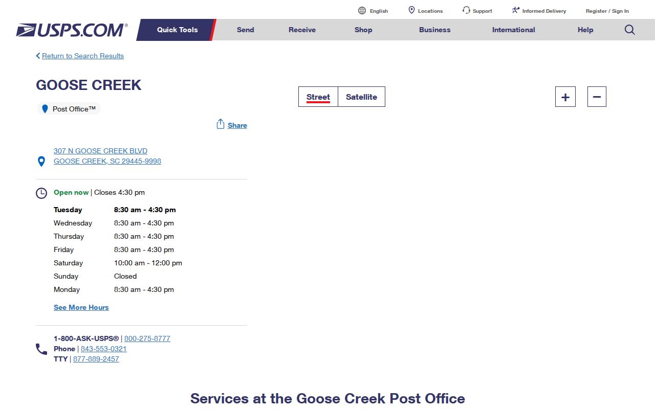
The USPS location record confirms the post office and ZIP 29445. It is the right evidence for a postal question, while county parcel data is needed for land-record research.
29445 Goose Creek ZIP
USPS lists the Goose Creek Post Office at 307 N. Goose Creek Boulevard with ZIP 29445-9998. The City uses 29445 for City Hall and its mailing address, and the state health visualization table labels the 29445 ZCTA as Goose Creek in Berkeley County. Together, those sources make 29445 the documented postal starting point for this postal directory.
A ZIP still has a limited role. It can help confirm how mail is addressed, but it does not supply a municipal-boundary decision or turn an address into a county parcel. For an individual mailing address, use USPS verification. For a jurisdiction or parcel question, retain the street address and move to the county and city GIS layers.
Goose Creek ZIP Lookup Limits
No official ZIP-wide property or resident search was documented for Goose Creek. Berkeley Property Search provides TMS, street number, street name, owner name, and separate mobile-home fields. The county GIS advertises TMS, owner, address, and street search. The county tax portal uses first name, last name, address, invoice number, or parcel number. My Property Insight accepts an address or street. None of those documented interfaces offers a ZIP field.
| Official tool | Documented entry fields | ZIP-wide option documented? | Best use |
|---|---|---|---|
| USPS address verification | Address-level delivery verification | Yes, for confirming a known mailing address | Postal ZIP confirmation |
| Berkeley Property Search | TMS, street number, street name, owner, mobile-home fields | No | Parcel and assessed-owner record |
| Berkeley GIS Advanced Map | TMS, owner, address, street | No | Parcel location and mapping context |
| County tax portal | First name, last name, address, invoice number, parcel number | No | Tax bill and payment context |
This is an important boundary, not a missing trick. Begin with a verified address, street, or TMS rather than expecting a postal directory to return an official roster.
Finding a Goose Creek ZIP
A reliable ZIP-based search starts with a full address and ends with the record system that actually indexes the question. Postal confirmation should come before a property or jurisdiction claim, especially when a result screen presents nearby ZCTAs.
- Check the known mailing address through USPS and record the ZIP returned for that delivery point.
- Keep the full physical address with the postal result. A ZIP alone is not enough to search Berkeley’s property or GIS tools.
- For parcel evidence, use the address in Berkeley County Property Search and retain the TMS from the matching card.
- Use the county map or City GIS Hub to determine the relevant parcel and jurisdiction context.
- When the question narrows to a particular road, continue with the Goose Creek street directory for the address-keyed parcel and deed sequence.
The South Carolina voter route has a different purpose. Its personal registration check requires name, county, and date of birth as shown on the voter card, rather than a ZIP-wide street browse.
Goose Creek Postal Record Tools
After USPS confirms delivery information, Berkeley’s parcel systems use TMS as the lasting bridge. The assessor card can show a site address, owner mailing address, lot or block information, parent TMS, deed book and page, plat reference, sale history, and jurisdiction or tax district. The county GIS connects the same parcel to map and aerial context. The City GIS Hub adds city property, zoning, land-use, development, and utilities context.
Berkeley GIS Advanced Mapping is the parcel-facing map, while the Goose Creek GIS Hub supplies the city-facing layer. Compare their roles rather than treating one ZIP label as a substitute for either map.
Insider tip: In Berkeley records, TMS is more durable than a ZIP for moving between city paperwork, county parcel cards, plats, and deeds. Log the postal ZIP as delivery information, then log the TMS for the record trail.
Goose Creek Parcel Address Types
Postal, physical, and legal descriptions can all appear in one inquiry, but they mean different things. The City’s zoning-verification process uses both a physical address and TMS because the postal address alone is insufficient. Berkeley GIS guidance says that Real Property Services receives recorded plats and starts assigning new TMS numbers. That chain explains why a record search should retain more than a ZIP.
- ZIP code
- A USPS delivery-geography label. It is not a city boundary, voting precinct, or parcel boundary.
- ZIP+4
- An added delivery detail after the five-digit ZIP. It refines mail delivery but does not replace a parcel identifier.
- PO-box ZIP
- A ZIP associated with post-office-box delivery. No Goose Creek PO-box-only ZIP was identified in the research.
- Unique ZIP
- A ZIP assigned to a single organization or address. No such Goose Creek ZIP was identified in the research.
- Carrier route
- A USPS delivery grouping. The research did not identify it as an official Goose Creek parcel or resident-search field.
Note: A site address marks a physical location, while the owner mailing address on a property card can be somewhere else entirely.
Goose Creek ZIP City Limits
A Census ZCTA is a Census geographic approximation of USPS ZIP geography. It is not the same thing as an incorporated city boundary. Census results may show 29406, 29410, 29445, 29456, 29461, 29483, and 29486 near a Goose Creek query, but the research did not find an official city delivery-area map that proves the surrounding entries serve the city.
The Census explanation of ZIP Code Tabulation Areas distinguishes ZCTAs from USPS ZIP geography.
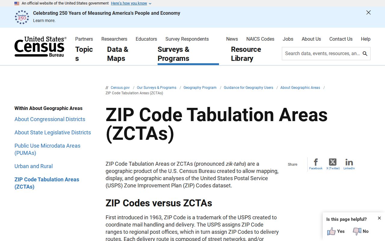
The Census material explains why a ZCTA and a USPS ZIP should not be treated as municipal-boundary proof. Use the city’s GIS resources for city limits, the county GIS for parcels, and USPS for delivery confirmation.
Boundary check. A nearby ZCTA is not evidence that a ZIP serves a Goose Creek address. Verify delivery address by address, then check the relevant city or county map.
Goose Creek Postal Counters
The record offices behind a 29445 address are not all in Goose Creek. City Hall and municipal court are at 519 N. Goose Creek Boulevard. The main Berkeley County Clerk and Probate offices are at 300-B California Avenue in Moncks Corner, and Register of Deeds, Real Property, and county FOIA contacts route through 1003 Highway 52 in Moncks Corner. A web result that fails does not mean the record has disappeared; the next documented route can be a county counter, phone contact, or request.
For recorded land material, the Berkeley County Register of Deeds offers an online index plus email, phone, and counter options. Current online index and image coverage begins July 1, 1983. With a correct book and page, deed and miscellaneous images can reach January 1974, while the office’s in-person land records begin in 1884.
Goose Creek ZIP History
Historic address research should not start with a ZIP. No authority reviewed documented a systemwide Goose Creek street renumbering or an official Goose Creek reverse-directory run. Instead, use a legal description, subdivision lot and block, plat, TMS or parent parcel, and recorded deed references to bridge an older record to a current location.
County GIS historic aerials begin in 1995 and can support a physical-development timeline, not an ownership conclusion. For older land material, the state archives guide documents Berkeley conveyance books from 1870 to 1964. The library’s documented 1956 Moncks Corner Community Directory is a regional historical resource, not a substitute for a verified Goose Creek ZIP record.
When a historical record gives only a subdivision, rural route, county, parish, or earlier jurisdiction, preserve that wording. Modern Berkeley County formed in 1882 from part of Charleston County, so an older reference may belong in a Charleston County-era or parish record rather than a ZIP-based search.
Limits of a Postal Route
Myth: a verified ZIP identifies the people at every address within it. In fact, USPS confirms delivery geography, while a Berkeley property card identifies an assessed owner and parcel. The card may separately show the owner mailing address and physical site address, but it does not list every household member or establish current occupancy.
Use the ZIP directory for postal verification, then let the address, TMS, legal description, and original records answer the narrower question. Respect address-confidentiality protections and use public records only for lawful personal research. Do not use postal or parcel information to stalk, harass, intimidate, or harm anyone.